|
Safety is an important issue for homeowners. People naturally prefer to live in a neighborhood that they perceive as safe.
The TEN BLOCK VILLAGE PLAN improves neighborhood safety by designing safer streets and by using a better method of naming
streets.
STREET DESIGN
1. First, dead end streets by their very nature have less traffic than through streets.
2. Second, a short street with a simple traffic-calming device will have slower traffic than a long thoroughfare.
3. Third, every residential street in the TEN BLOCK VILLAGE PLAN forms a "T" intersection when it joins the
collector street called Village Drive. A "T" intersection will force automobiles on the residential streets to
slow down when they approach Village Drive. Drivers must slow down to successfully make the 90-degree turn onto Village Drive.
These three points should work together to create safer streets from a traffic accident viewpoint.
STREET NAMES
Life and property are in jeopardy whenever rescue personnel make a wrong turn. The PLAN helps prevent wrong turns by
using only "T" intersections and by providing each and every residential street has its own unique name -- a street
name found nowhere else in the county.
The street names are in alphabetical order from the west end of the village to the east end. Not only does a unique name
help develop a neighborhood identity, it also makes it easier for the police, firefighters and EMS personnel to find the address
they are looking for.
Audubon County, Iowa was named after the famous 19th century naturalist John James Audubon. All of the north-south county
roads are named after birds in alphabetical order, beginning with Avocet Place and Bluebird Place in the western part of the
county and continuing to Robin Avenue and Swift Avenue in the eastern part. This system of naming roads not only provides
a pleasant theme for the county, it also makes it easy for motorists to find the road they are looking for.
For example, let's say the fire department was driving east on Highway 44 in response to a fire on Swift Avenue. The
fire fighters would know that they are very close to Swift Avenue when the truck passes Robin Avenue. The driver could anticipate
the name of the next road even before the street sign was close enough to read.
|
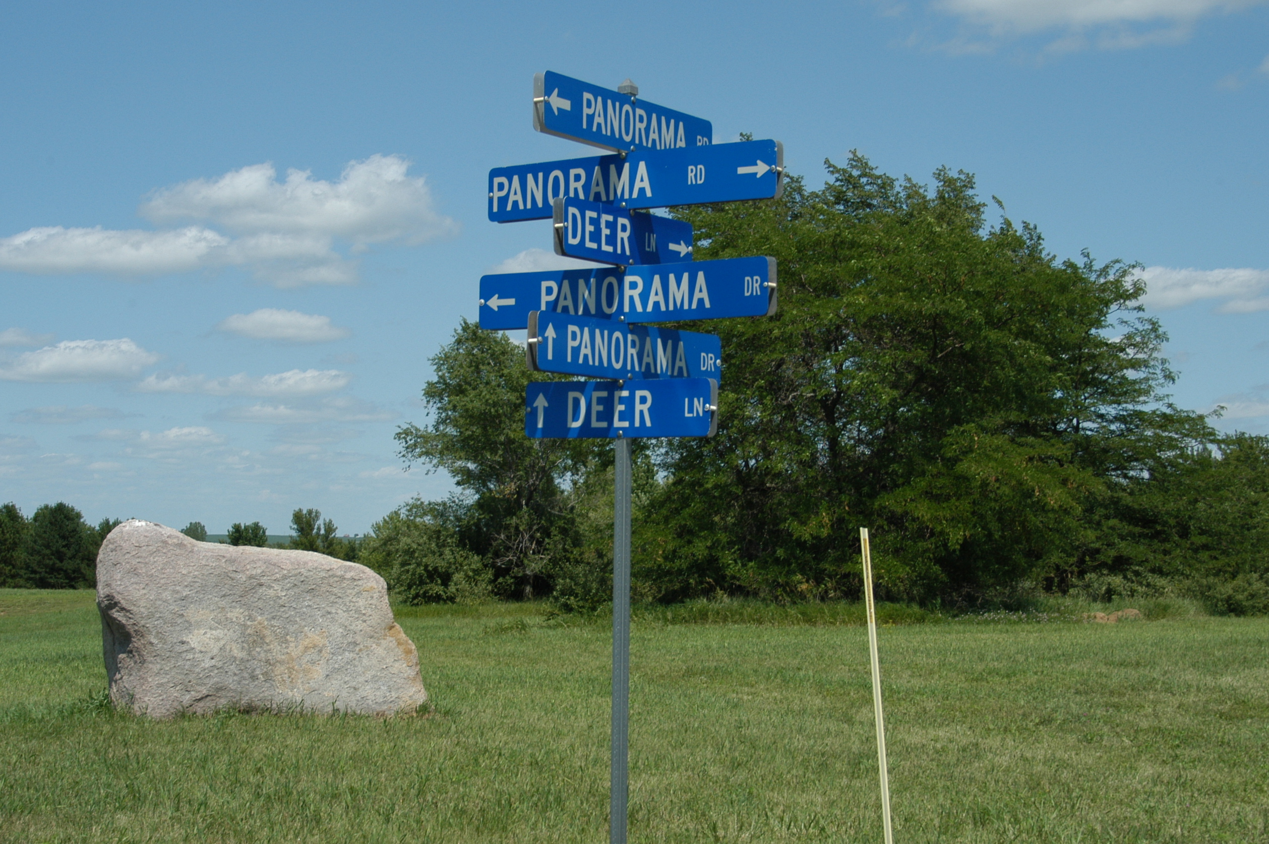
| Do Not Follow This Example |
I formerly worked for Lake Panorama Association, near Panora, Iowa. Lake Panorama is a beautiful community with an incredibly
confusing street system. Its developer did not use any of the principals that I now call the TEN BLOCK VILLAGE PLAN.
The 6,000-acre private community of Lake Panorama has Panorama Road, Panorama Drive, Panorama Way, Panorama Point and
Panorama Terrace. Furthermore, Panorama Drive is found on both the east side and the west side of the lake. Panorama Drive
intersects Panorama Road six times! Even longtime residents get confused when driving to an address at Lake Panorama for
the first time.
THE TEN BLOCK VILLAGE PLAN creates a simple, intuitive pattern that first-time visitors can easily understand.
NEXT PAGE
TOP OF PAGE
|